Argonne’s EVS and Energy Systems and Infrastructure Analysis (ESIA) divisions are providing technical support to the Eastern Interconnection States’ Planning Council (EISPC) for an energy zones study.
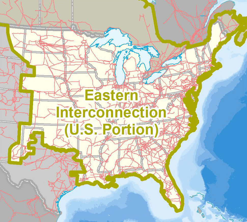
The EISPC study examines nine types of energy resources for development of clean energy generation facilities in the U.S. portion of the Eastern Interconnection (see map below): (1) biomass, (2) clean coal technologies with carbon capture and sequestration, (3) geothermal, (4) natural gas, (5) nuclear, (6) solar (photovoltaic and concentrated solar thermal, as well as rooftop photovoltaic solar), (7) storage (pumped-hydro storage and compressed-air energy storage), (8) water (hydroelectric power), and (9) wind (both land-based and offshore). For each of these major categories, EVS and DIS compiled, reviewed, and assembled the resource data into a geographic information system (GIS) database. The information in the database is being made accessible in a web-based EISPC Energy Zones Mapping Tool that will allow stakeholders to identify potentially suitable areas for clean energy resources or to determine potential clean energy zones.

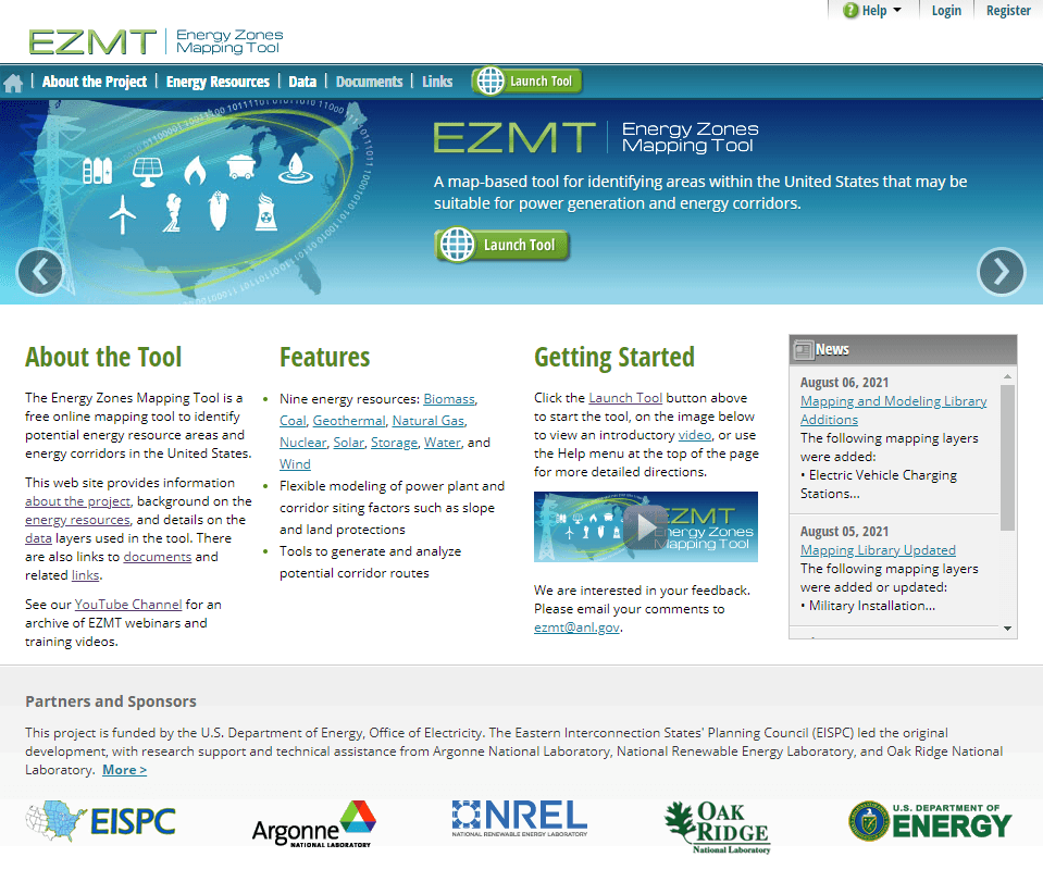
EVS is leading the GIS and web development effort for the Energy Zone Mapping Tool and is contributing to interactions with EISPC, project teams, energy technology experts, and stakeholder groups. Notable technical approaches include the use of open-source programming libraries for all web development; highly scalable cloud architecture for the server; a form-based administrative interface for maintaining the content; and flexible user interfaces for the GIS map layer catalog, models, and reports. The website and tool (below) are accessed by federal and state planners, nongovernmental organizations, grid operators, energy industry professionals, and others. Interested stakeholders are invited to access the website and register for the tool at https://ezmt.anl.gov.
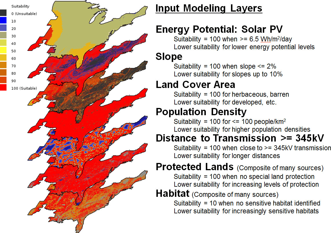
With the tool, EISPC stakeholders can use energy resource availability, screening parameters, and other criteria to develop customized maps depicting the suitability of different areas in the Eastern Interconnection for clean energy resource development. The first image below shows the default input mapping layers and parameter settings for the draft utility-scale solar photovoltaic power suitability model. The second image below displays the model output.

The analysis approach and the tool are not intended to support a detailed siting analysis for any specific clean energy project. Rather, the intention is to enable stakeholders to identify, on a map, clean energy resource areas that could potentially be developed as energy zones.
The tool gives users these capabilities:
Learn about clean energy resources and power generation technologies.
View and query map layers (more than 260 in catalog).
Analyze any of 29 clean power generation and storage technologies capable of grid-level power production.
Run flexible models that generate “heat maps,” identifying areas of high suitability for developing clean energy resources.
Specify analysis areas.
Run reports customized to user-specified analysis areas.
Export static images of map layers and modeling results.
Access metadata for the GIS layers.
Access over 100 environmental data layers to account for protected lands, imperiled species, and other environmental factors while determining whether certain areas are suitable for the development of clean energy resources.
Access a database of policies and laws that encourage or inhibit potential clean energy resource development.
Argonne leads the EISPC technical work, in collaboration with the National Renewable Energy Laboratory and Oak Ridge National Laboratory, and in partnership with the Eastern Interconnection Planning Council, Navigant Consulting, and the Clean Energy States Alliance. Commercial information licensed for the project includes data from Bentek Energy/Platts, AWS Truepower, and NatureServe. Funding is from the U.S. Department of Energy.