Few people have considered the uses for unmanned aerial vehicles (UAVs), or drones, beyond children’s toys or aerial cameras. But their applications are as limitless as the imagination, and scientists at Argonne National Laboratory are exploring some of the areas in which they could be useful.
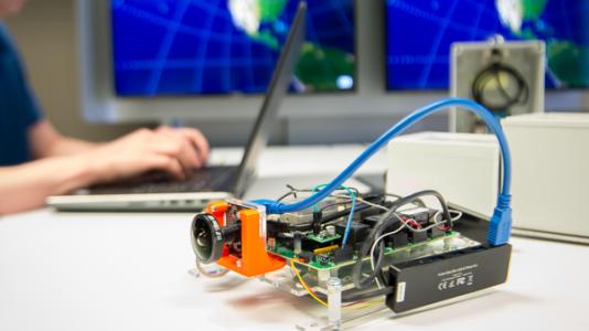
Researchers at the lab are testing potential applications for UAVs in a plethora of areas, including wildlife management, archaeology, transportation and agriculture, through projects funded by Argonne’s Laboratory-Directed Research and Development (LDRD) program. Growing out of these projects is the Mission-Driven Unmanned Aerial System Design Center, a broad-based initiative that will tie together UAV-centered research happening at Argonne.
One project focuses on external aerodynamics, including blade and wing design, and is led by Sibendu Som, Manager of Multi-Physics Computation at Argonne. Autonomie, a math-based simulation environment tool developed in the Center for Transportation Research (CTR), is being redeveloped into Aeronomie, a tool that can be used for UAV design to predict range, performance, energy consumption, and component requirements for mission-specific design. Additionally, CTR research on battery efficiency and light-weighting will be applicable to making UAVs more effective at their jobs.
Another focus of the project extrapolates from an area of expertise within the CTR–combustion science. Many larger drones used for military applications, data gathering, and package delivery rely on additional power sources beyond the battery, namely combustion engines. Argonne’s expertise in analyzing and improving engine performance, coupled with the lab’s computation and combustion modeling capabilities, could extend the range of UAVs by efficiently using combustion engines for specific purposes.
“The capabilities that we have developed under the Virtual Engine Research Institute and Fuels Initiative program can be applied to optimize the combustion system in these small engines,” said Som.
Argonne’s leadership in advanced energy storage technologies can also lend a hand to improving UAV systems. The lab’s intensive study of lithium-based batteries, which are common in UAV technologies, could potential be applied to evaluate drone design options, including battery-powered and hybrid architectures.
Still other researchers are exploring UAV applications through a different lens. Argonne biophysical remote sensing scientist Yuki Hamada is leading a benchmarking project to explore the capabilities of UAVs in three experiments using an infrared camera and a multispectral optical camera having four spectral channels.
One experiment uses the cameras to detect old structural foundation remaining underground, invisible to the naked eye. By flying UAV over extensive areas of empty ground, this type of application would help archaeologists identify likely areas of underground artifacts for further exploration while saving time and resources.
In the second experiment, being carried out on Argonne’s campus, researchers are flying UAVs over woodlands to document the appearance and conditions of trees throughout the season. The data can be used by natural resources managers and ecologists to determine different tree types and understand woodland health to support wildlife habitat. This type of UAV application is relevant for energy development for ensuring environmentally sustainable energy development and operation to best determine ways to work symbiotically with nature.
The third experiment monitors grassland to quantify aboveground biomass and plant water content. The camera on the UAV enables researchers to estimate vegetation properties such as crop health, water use, and yields in agricultural field to improve efficiency and effectiveness of crop management including bioenergy crops.
This type of monitoring also has uses in the transportation sector; it can deliver real-time information on congestion and traffic patterns around evacuation routing or special events. Monitoring transportation networks could also have extremely useful inputs for society, such as quick reporting on problems with public transit, or up-to-the-minute information on riders.
The new Unmanned Aerial System Design Center will create a platform for Argonne researchers to collaborate and put together the pieces of the puzzle of the future of drones. It will be exciting to see what applications arise to improve our everyday lives.