Across the major metropolitan areas of the United States, understanding the way in which people and vehicles move is a complex myriad of challenges for everyone from city planners and urban developers to the United States Department of Energy and Department of Transportation.
Congestion, energy usage, emissions, public transit access, equity and safety; these are just a few of the challenges that researchers must consider when analyzing transportation systems.
In addition, as new technologies continue to gain market share (e.g., transportation network companies) or be introduced (e.g., e-scooters), decision makers need to quickly and accurately understand their impact on the entire network to reap their full benefits and avoid unintended consequences.
For example, if the use of ridesharing services increases, how will people change their daily trips? How and where will new technology affect congestion? How will new mobility services impact public transit systems and energy consumption? Fortunately, high-fidelity simulations of large scale metropolitan areas can answer these questions and give decision makers the insights they need to better serve their communities.
At Argonne, scientists in the Energy Systems Division developed POLARIS to tackle such an undertaking. POLARIS is an open-source transportation systems simulation tool, designed to simulate large-scale transportation networks. It uses a discrete-event, agent-based modeling framework to simulate the behavior of individual agents within any given transportation network.
While its efficient use of memory allows POLARIS to be run on common desktops, an extremely large number of scenarios need to be considered to understand the potential impact of each technology and the associated uncertainties at the system level. As a result, Argonne scientists have been working to simulate POLARIS on high-performance computing (HPC) platforms, using Argonne’s supercomputing capabilities.
“Argonne’s unique HPC capabilities allow us to launch and manage an unprecedented number of simulations at once,” said Principal Computational Transportation Engineer Joshua Auld. This allows the scientists to analyze a large number of scenarios and the variance across simulations for any number of variables, from traffic flow to energy consumption.
During a simulation, each agent continuously makes its own travel decisions, from departure times and route choices to destinations and on-the-fly rescheduling. “POLARIS is truly unique,” said Vehicle and Mobility Systems Section Manager Aymeric Rousseau. “POLARIS is the only system of its kind integrating and simulating traveler decision-making behavior like this. We can model each person throughout their day based on their individual preferences.”
One of the most innovative aspects of POLARIS is its ability to simultaneously consider all those variables for any given agent. The agents themselves are then all simulated, across the entire network in real-time. By considering the entire system, one can view the effects of changing certain parameters within the network, such as delays at major intersections or changes in vehicle technologies (e.g. connectivity, automation, electrification).
Despite POLARIS’s high model fidelity, the tool is still extremely computationally efficient. “Where other tools use only 3 to 5 percent of agents in a network and take days to run their simulations,” explained Rousseau, “POLARIS runs simulations using 100 percent of a network’s agents in three to four hours.”
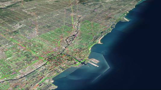
The Chicago metropolitan area was one of the first cities whose transportation network was modeled in POLARIS. Across an area of approximately 10,000 square miles, POLARIS was able to simulate a full day of travel for upwards of 10 million agents in several hours.
By modeling the entire population within a transportation network instead of merely a small sample of the agents, POLARIS is able to provide higher-fidelity results, which helps reduce the uncertainty for decision makers.
“This information is crucial for everyone from emergency planners and those designing new infrastructure within cities to automotive companies trying to predict how their business models might shift with these new vehicle and mobility technologies,” Rousseau said. He also highlighted the human benefit of harnessing this information as well. “We have seen how new mobility technologies have helped improve people’s lives, extending transportation access to underserved populations and regions or individuals who cannot drive themselves.”
Understanding and quantifying these changes in our transportation networks will help us make the best choices to improve the lives of everyone in their cities and communities.
The initial development of Polaris was funded by the U.S. Department of Transportation and the Federal Highway Administration. Its continued development is now supported by the U.S. Department of Energy’s Vehicle Technologies Office within the Office of Energy Efficiency and Renewable Energy.