Environmental Science

ATMOS Capabilities

Throughout the multiple zones of the ATMOS site, up to 60 instruments can be deployed. These instruments measure everything from temperature and wind speed, to pressure, soil moisture, and precipitation.

See below for a list of instruments and their capabilities at ATMOS. Note that not all instruments are deployed in the field at the same time. (*) Denotes not currently deployed in the field.

60-meter Tower (Image by Argonne National Laboratory)

60-Meter Tower Measurements

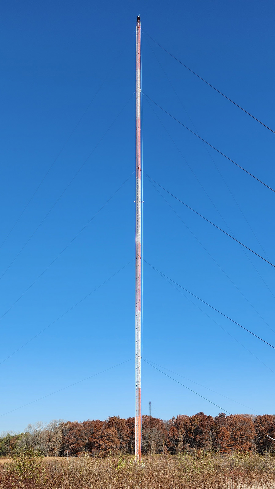
The tower measures temperature, wind speed and direction at both 10 and 60 meters, as well as net and solar radiation. These measurements help to evaluate and model conditions, stability, and transport at a very low level of the atmosphere.

(Measurements at 10 and 60 meters unless otherwise noted)

  • Temperature/Dew Point Temperature
  • Wind Speed and Direction
  • Solar/Net Radiation (2m)
  • Pressure (1m)
  • Soil Moisture (0.1m, 1m, 3m)


Precipitation

Matt Tuftedal and Joe O’Brien working on a SAGE node with a low-cost weather station mounted on the pole (Image by Argonne National Laboratory)

These instruments are used to measure precipitation in liquid or solid forms. From the most basic melting and tipping of a bucket to lasers with a fixed field of view, these measurements are critical to safety and the well-being of Laboratory employees and beneficial for National Weather Service forecasters to identify areas of variable precipitation.

  • Belfort Tipping Bucket x 2
  • Vaisala FD70 Forward Scatter Sensor
  • Parsivel Disdrometer
  • ECRN-100 Tipping Bucket x 3
  • OSI All-Precipitation-Gauge (*)

Sub-surface

Subsurface measurements of soil moisture and temperature are routinely taken at ATMOS. These measurements are crucial for the Argonne ecology and meteorology departments.

  • TEROS11 Soil Moisture and Temperature x 64 sites (15 cm, 5 cm[*])
  • LICOR LI8100 Soil Respiration x 4 sites
  • STEVENS HydraGO Soil Moisture Probe (*)
  • Lysimeter G3 Drain Gauge (*)
  • PHYTO31 Leaf Wetness x 6 (*)
  • SATURO Saturated Hydraulic Conductivity (*)
  • HYDROP Soil Moisture Release Curve (lab instrument*)

Aerosol/TRACE Gas

Argonne is in the process of acquiring a wide array of aerosol and trace gas measurement technologies to add to the preexisting technology base. These instruments will measure greenhouse gases and other pollutants, directly contributing to the body of knowledge surrounding the changing climate.

  • Serinus 10 Ozone x 3 (*)
  • Serinus 30 CO/CO2 x 2 (*)
  • Serinus 40 NO, NO2, NOX x 2 (*)
  • VOC100 Methane/Hydrocarbon (*)
  • TEOM1405 PM1, PM10 (*)
  • TEOM1405-F PM2.5, PM1 (*)
  • Vaisala AQT530 PM, NO2, NO, CO, O3
  • Handix POPS Aerosol Size distribution
  • Met One Dust Meter PM2

Profiling/Remote Sensing

Scanning doppler lidar

Remote sensing instruments are used to measure wind speed/wind direction, precipitation rates and amount, boundary layer height and turbulence, and cloud height and cloud coverage.

  • Vaisala Radar Wind Profiler x 2
  • Sonic Profiler
  • Scintec Sodar
  • Microwave Rain Radar
  • Scanning Mini-Micropulse Lidar
  • Vaisala Ceilometer CL-61 x2
  • Halo Photonics Scanning Doppler Lidar

Surface

ATMOS can measure CO2, H2O and methane fluxes at the 20-acre site using 3-dimensional wind measurements and through gas analyzers.

  • LI-COR 7500RS CO2/H2O Analyzer
  • LI-COR 7700 Methane Analyzer
  • Gill Sonic Anemometer